This Will Create BLIZZARD Conditions...
21.77k views1711 WordsCopy TextShare
Weather On The Go
Thanks for watching! Press the THUMBS UP 👍 if you liked the video & SUBSCRIBE to stay updated on th...
Video Transcript:
today is Thursday December 5th 2024 and in this video we're going to be talking about an Arctic air mass settling in as we end the week but we have a warmup in store as we go into this upcoming weekend Lake Effect snowfall lots of that and we're going to be talking about the upcoming pattern by the middle of December in this video so looking here at the surface pressure and the fronts today notice that cold front that moved through with all that wind yesterday across the Midwest is All the Way South moving into the southeastern
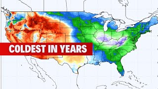
United States and moving into the Mid-Atlantic and that is attached to an uding low pressure system up here into portions of Quebec and Ontario at 992 mbars and looking at that colder air mass that is moving in today and you can see temperatures are easily 20 25 if not 30 Dees below the average here for this time of year down into the southeast whereas the West is starting to see temperatures above average here with temperatures that are 30 35 and even 40° above the average for this time of year notice the colder air remains across
the east as we go into Friday some of that mild Pacific air as that Ridge starts to flatten out does start to make its way East towards parts of the black hills region of the dtas and into parts of the Plains tomorrow on Friday and then once we get into the weekend those above average temperatures will start to move into to the Midwest more the Plains and even into the Ohio Valley as we go even into Sunday so definitely seeing a warm up in store as we go into this upcoming weekend let's look at our
afternoon highs here on this Thursday afternoon it's going to be a cold one across the Upper Midwest we're staying into the teens across parts of the Upper Midwest and the 20s across the lower part of the Midwest like Iowa Illinois and Missouri and then the Ohio Valley remaining into the 20s today and then the 30s up here across interior Northeast and New England and even notice down here in Nashville at 33 for a high this afternoon definitely pretty chilly let's look at our low temperatures to start off the day on Friday if you're headed off
to work or school it's going to be a cold one make sure to bundle up with a jacket a scarf some gloves out there because temperatures are going to start off in the single digits and teens across the North and that freezing line yes that freezing line goes all the way south to near the Gulf Coast and parts of Northwest Florida like Panama City may be waking up at 30 2° tomorrow morning so it's going to be very chilly but temperatures do rebound tomorrow afternoon into the plains especially as that mild Pacific air comes from
west to east across the country and you can see more 40s and 50s returning across the plains after what is a cold start tomorrow we're still remaining into the 20s and 30s across the Great Lakes the Ohio Valley and the Northeast but we are going to warm up a smidge as we go into tomorrow compared to what we see this afternoon and then Saturday afternoon we're going to warm up even more more than that and then by Sunday we're going to warm up a little bit more than we did on Saturday so it's kind of
a cumulative effect here we're going to warm up each and every day as we go through the weekend and then by then look at that 50 Dees by Sunday afternoon in the lakefront in Chicago and Milwaukee 55 in De Moine and maybe just maybe approaching 60 again in Tulsa and Oklahoma City as we go into Sunday let's look here at the weather alerts across the country we still have those winded iies over here in the Mid-Atlantic and Coastal New England that is where we have the tan shaded colors the purples those are winter weather advisories
travel is a little bit inconvenienced in those areas with snowfall and blowing snow as well and then we have in the pinks those are winter storm warnings that is where more significant travel impacts are expected with either snow and or blowing snow in those areas even some blizzard warnings for areas near Eerie Pennsylvania and even down the ations there from Western Maryland into West Virginia those blizzard warnings there in the orange where significant blowing and drifting is occurring so that is really tied to the wind right so we're seeing a lot of those strong wind
gusts over 40 over 50 miles per hour across the Great Lakes today especially even over here in the Mid-Atlantic and Coastal New England from New York City and Long Island all the way up through Hartford and even into Boston so it's going to be very windy over there through your Friday time frame let's look at precipitation we still have the lake effect snowbands very significant going strong across the Great Lakes today some snowfall from Maine back all the way down into Northern Pennsylvania and some light to moderate snow there that'll continue into tonight the snow
bands are going to continue and then as we go into Friday it's really going to be just those lake effect snow bands as we go into Friday and then into Saturday a new Clipper system Moves In from Canada across Manitoba and Ontario that could bring some snowfall again and reag gravate those Lakes again for more lake effect snow on Saturday and then another storm system again trying to develop across Canada and toward North Dakota and Northern Minnesota on Sunday that could bring a mix of rain snow and maybe even some sleep up there as we
go to that time frame rainfall further south so Coastal Texas Arkansas Louisiana parts of Mississippi by Sunday will be pretty wet as well with some light to moderate rain showers maybe a few thunderstorms mixed in non severe as we go into Sunday looking here at the snowfall we're going to be seeing a few inches of snow for the great Lakes again and also up here into the Northeast from Maine All the Way Southwest towards Northern Pennsylvania a few inches of snow across the Pacific Northwest too and you can see here the Cascades from Washington State
southbound into Oregon could be seeing as much as a foot of snow in some of these areas especially on Washington State's side of things over here into Idaho into portions of Western Montana Northwestern Wyoming a few inches of snow there as well looking at the Great Lakes we have a few more inches of snow for Michigan uh the up Michigan lower Michigan and then over here in towards portions of the Northeast from Maine all the way back Southwest through New Hampshire Vermont into Massachusetts maybe even into Connecticut there much of New York State and into
Northern Pennsylvania a few to several inches worth of snow the heaviest of which will be up here in Maine where we could be seeing over 12 Ines of snow in some areas so definitely another foot of snow on the way and that will impact travel too so the biggest snow band The most significant one is up here in Erie Pennsylvania where we have the blizzard warnings major travel inconvenience there as we have snow combined with the wind so blowing snow and that's creating white out conditions so make sure if you are traveling and you have
to travel for your job here in this area make sure you leave with plenty of time because it will take time to get to your destination that is for sure let's look ahead as we go into next work week Monday December 9th through Friday December 13th we're going to see that mild Pacific air off of the western us with that Ridge flattening out is going to start to shift East a little bit into the Central and Eastern us we're going to start to see above average temperatures and we're also going to continue to see more
active weather from the Eastern Seaboard all the way back across the Northern Tier of the United States with more drier conditions expected from California stretching over towards Kansas Texas and Oklahoma and even parts of Missouri as we go into next week looking at snowfall prospects over the the three operational models the European model here he has a little bit of snow across the north as we go into next week a little bit more of a significant storm potential across the Northeast in the Mid-Atlantic again the track the intensity the moisture it has to work with
is all key here so it's not set in stone that we see additional snow in New York state Pennsylvania or anything like that we'll keep you updated uh the GFS model again has that snow line a little bit further north so again some disagreement there between the European and the GFS model which is the American guidance and then the G guidance that is the Canadian model suite and we have that again more lake effect snow more heavy snow from Ontario into Quebec and less snow across the Northeast so there is some type of storm that
could develop across the Eastern Seaboard that could move up the East Coast with maybe Coastal rains and or snow so we'll keep an eye on that as we go into next week but again nothing is set in stone and a lot can change between now and next week so we'll keep you covered right here on this channel thanks for watching make sure to subscribe to the channel if you are new like the video down below if you haven't already and also leave any comments questions concerns below we'll get to those after the video and I
hope everyone has a terrific rest of your Thursday out there
Related Videos

9:14
7.0 quake strikes Northern California, tri...
ABC7 News Bay Area
5,477 views
18:10
12/5/24: STRONG Storm to Kick Off an Activ...
Josh's Severe Weather
3,090 views
20:15
Models Expect Another Massive Arctic Invas...
Direct Weather
6,331 views

19:03
If You Grew Up in the 1970s…You Remember T...
Recollection Road
1,562,421 views

32:42
The May 6, 2024, Oklahoma High Risk: A Met...
Convective Chronicles
7,751 views

7:45
California earthquake captured on video | ...
ABC10
68,129 views
16:31
How much snow will Massachusetts get? Mete...
CBS Boston
7,717 views

23:21
How an ANNOYING B-SIDE Nobody Wanted--Beca...
Professor of Rock
535,026 views
7:43
Erie, Pennsylvania Digs Out From One Major...
FOX Weather
52,893 views

12:43
DEVASTATING!
Dr. Eric Berg DC
1,345,996 views
13:26
California Weather: Updates on water, rese...
ABC10
3,580 views
8:09
This Will Dump A TON Of Snow...
Weather On The Go
59,984 views

1:37:34
The Groundbreaking Cancer Expert: (New Res...
The Diary Of A CEO
5,623,611 views
7:06
Winter storm: Alberta clipper to drop snow...
NEWS CENTER Maine
2,616 views

21:20
1950s to 1980s Christmas Retrospective
Recollection Road
90,744 views

12:04
First 12 Minutes of MTV
Jersey Mark
1,579,922 views

12:57
3 Epic Chocolate Chip Cookies for Every Mood
Brian Lagerstrom
28,145 views
9:03
Coldest December start for some in over a ...
Meteorologist Travis Roberts
766 views

23:17
How Boston & Tom Scholz FOOLED The MUSIC I...
Rock N' Roll True Stories
331,950 views

16:36
California Gov. Gavin Newsom gives update ...
ABC10
731 views