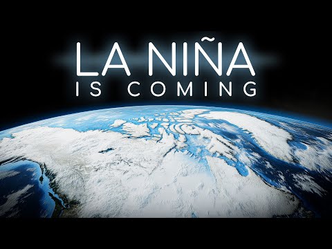
What La Niña Will do to Earth in 2025
1.15M views2923 WordsCopy TextShare

Astrum
After the extreme weather events and early end to El Nino, what can we expect from La Nina?🔒Remove ...
Video Transcript:
Imagine a force so powerful that it can change weather patterns around the world and even alter the fate of ancient civilisations. Earth’s short term weather patterns and long term climate are influenced by a complex collection of factors, from our place in the solar system and the planet’s rotation, to atmospheric patterns and seasonal changes. To further complicate things, every few years our planet experiences El Niño and La Niña events – two opposite ends of a cycle that are part of the El Niño Southern Oscillation, or ENSO for short.
Evidence of the ENSO goes back tens of thousands of years, and may have even played a role in destabilising some of the world’s great ancient civilisations. One of the five strongest El Niño events ever recorded has finally come to an end as of June 2024, after months of record-high ocean surface temperatures, unprecedented heat stress on coral reefs, drought in the Amazon rainforest, and extreme rainfall with dangerous consequences for North America. With La Niña predicted to begin in late 2024 or early 2025, what changes can we expect globally, and locally?
I’m Alex McColgan, and you’re watching Astrum. Join me as we take a look at our changing planet, the ENSO, and what La Niña will do to Earth. Our previous video about El Niño explored one side of a global cycle that typically takes between 2 to 7 years to swing from one extreme to the other.
These El Niño and La Niña episodes usually last 9 to 12 months, but can last for several years. In this video we will take a closer look at how this cycle works, what neutral periods are, and what might happen as we head into the opposite extreme of La Niña in the coming months. When our Earth experiences average conditions, we call those periods “ENSO-Neutral.
” But every few years, fluctuations in wind and ocean surface temperatures can signal the beginning of an El Niño or La Niña event, and a departure from Earth’s normal conditions. These events alter worldwide atmospheric patterns and are known to wreak havoc by contributing to extreme weather and environmental harm. Imagine we're on the International Space Station orbiting Earth.
From here we can see our planet’s spherical shape, and as you might expect, sunlight affects the Earth’s surface unevenly. More light and heat reaches Earth at the equator where sunlight strikes most directly, compared to the poles where sunlight reaches our planet at a low angle. In the same way that a hot air balloon rises, or hot steam rises over a pot of boiling water, the same thing happens along the equator.
. Direct sunlight warms up the air, and that hot, moist, low pressure air rises up into the atmosphere. As the warm air gets higher, it begins to cool off and condense into clouds – this is why we see an abundance of tropical rainforests close to the equator.
More warm air continues to rise, pushing the cooler air away from the equator and out towards the north and south, where it will eventually sink back down to the surface. Then, that cool air will move from higher pressure, along the surface of the Earth, back to lower pressure near the equator to start the cycle all over again and complete what we call Hadley Cell rotation. But how does this worldwide circulation of air, driven by the Sun, relate to El Niño and La Niña events?
The surface winds created by these Hadley Cells are deflected towards the equator due to the Earth’s rotation, a phenomenon we call the Coriolis Effect. It’s this effect that creates the trade winds on either side of the equator, and it’s changes to these trade winds that indicate when we will experience El Niño and La Niña events. Historically, the trade winds have been so reliable that sailors have used them to navigate the globe for centuries, hence the name, “trade winds.
” Chemical signatures of the ENSO stretch back tens of thousands of years in paleoclimate indicators like coral fossils, and we have written records of the ENSO as far back as the 1500’s. . El Niño events may have aided Spain in their conquest of the Incan Empire in the 1500’s, and in the late 1700’s, likely contributed to crop failures and unrest that sparked the French Revolution.
Despite this long record of ENSO activity and the massive impact it has on worldwide weather and environments, it wasn’t until the 20th century that we finally started to understand the mechanisms behind it. The first defining breakthrough came in the 1920s, when a British scientist named Sir Gilbert Thomas Walker set out to better understand the strength of monsoons in India. In his search for a way to predict monsoon strength, he ended up documenting the Southern Oscillation, a repeating shift in air pressure that happens across the equatorial Pacific Ocean.
This oscillation was part of another large-scale air circulation that had not been documented before, and was later named the Walker Circulation. Remember how I said that Hadley Cells circulate air north and south? The Walker Circulation is just like Hadley Cells, except instead of moving air north and south, the Walker Circulation moves air to the east and west over the equatorial Pacific.
And instead of being driven by sunlight, the Walker Circulation is guided by the easterly trade winds and ocean temperature. It would be 60 more years before scientists were able to connect these changes in air pressure over the Pacific with the alternating pattern of warm and cool surface water in the Pacific. Combined, these make up what we now know as the El Niño Southern Oscillation – ENSO.
El Niño refers to the changes in sea surface temperature, and the Southern Oscillation refers to the simultaneous changes in air pressure. Unlike Hadley Cells that reliably move air north and south, the equatorial Walker Circulation is not consistent and can experience colossal shifts as part of the Southern Oscillation. Every few years, the surface temperature and trade winds over the Pacific experience fluctuations, signalling an oncoming shift in the Walker Circulation.
In turn, these shifts, which we refer to as El Niño or La Niña events, can upset the balance of weather and ecosystems over the entire Earth. So what happens to the Earth during each of these? During neutral ENSO periods, the sea surface temperature and trade winds are near average conditions.
Trade winds blow across the Pacific Ocean, guiding warm surface waters to travel west from South America towards Australia and Asia. As that warm surface water moves west, it makes way for deep, cooler waters to rise up in its place. This ocean circulation brings nutrient-rich cool water to the surface in a process called upwelling, where it feeds phytoplankton and in turn supports other parts of the ecosystem like fish.
In neutral periods, weather across the world occurs, more or less, as expected. This can include normal hurricane development in the Atlantic, and average monsoon rainfall across southeast Asia. Walker Circulation drives columns of warm moist air to rise above southern Asia,northern South America, and middle Africa, so it’s no coincidence that these three regions are where we see a concentration of vast, lush rainforests.
The influence of this equatorial airflow is vast, so it’s easy to imagine how changes to this system could cause a ripple effect around the world. The first signs of trouble are when the trade winds begin to weaken and sea surface temperature rises in the Pacific, which can indicate an oncoming El Niño event like the one we experienced in 2023 and 2024. During El Niño, the colossal columns of warm air that rise above our world’s rainforests are shifted to the east or west.
This change disrupts Asia’s monsoon season with prolonged droughts and water scarcity, and affects the livelihoods of billions of people in east Asia. The last El Niño also brought nine atmospheric rivers to the western United States that led to major transportation issues, dangerous landslides, and flooding. You can think of an atmospheric river like a river of moisture streaming through the air.
When these atmospheric rivers reach land, they release all of that moisture, causing monumental precipitation. Everywhere on Earth, this shift in Walker Circulation is felt during El Niño. However, the changes you experience in your local weather conditions may be completely different from the changes another person sees in their local weather elsewhere on our planet.
El Niño typically brings a reversal of the normal conditions for a given area. This is why places like east Asia or the Amazon rainforest, which typically get plenty of rain, will experience drought during an El Niño event, or why usually dry climates like western North America, will experience tremendous rainfall events. The recent El Niño event was also responsible for worldwide shipping delays in 2023, as there wasn’t enough water to feed the Panama Canal, which relies on consistent rainfall to accommodate all of the cargo ships hoping to pass through.
El Niño is described as the warm part of the ENSO cycle because Pacific sea surface temperatures are higher than average during this time. In addition to changing worldwide weather patterns, this also negatively affects ecosystems. Take, for example, coral reefs.
They rely on particular sea surface temperatures to survive, and support some of the most important and biologically diverse life on Earth. Corals have a symbiotic relationship with algae, but an increase in water temperatures can cause the coral to expel this algae, leaving it drained of colour and vulnerable. A reef can recover from this bleaching if conditions improve in time, but their risk of dying is high, and the last El Niño event was no exception.
An unprecedented 99. 7 percent of Atlantic tropical reefs were impacted by bleaching-level heat stress during the 2023 to 2024 El Niño event, as part of the fourth worldwide mass-bleaching event in recorded history. The warmer Pacific waters and weakened trade winds from El Niño also cause the upwelling of cooler, nutrient-rich water to temporarily slow or stop, leading to a dire situation where less phytoplankton means large numbers of fish must migrate or perish.
As you can imagine, this ripples across the food chain and can impact other animals. For coastal families and communities who rely on those fish for nourishment or income, this El Niño effect can be devastating. Now that we’ve discussed what it’s like during a neutral ENSO period, and the destructive changes that can happen with El Niño conditions like we saw in 2023 and 2024, what can we expect from this upcoming La Niña phenomenon?
La Niña is the other extreme. This period is marked by stronger than usual trade winds, and cooler than average Pacific sea surface temperatures. While El Niño usually causes the reversal of neutral conditions, the best way to understand La Niña is to think of it as a more intense version of neutral conditions for most parts of the world, with a few exceptions.
During La Niña, the neutral columns of rising warm air above south Asia and eastern North America become more pronounced, while the typical column of warm air above Africa reverses. Just as your experience of El Niño is highly dependent on where you are located, the same is also true of La Niña. As of August 2024, the U.
S. National Oceanic and Atmospheric Administration predicts a 66 percent chance that La Niña will develop between September to November of 2024, and a 74 percent chance it will last well into the Northern Hemisphere’s winter of 2025 to 2026. And as of this video, models are predicting a roughly 50 percent chance that this La Niña event will peak at a moderate strength.
However, while forecasts for a La Niña event happening are usually correct, the predicted strength for these events will likely change from month to month. A strong El Niño ending in 2024 does not necessarily mean the upcoming La Niña will be as extreme. Sometimes a strong El Niño leads into a strong La Niña, but other times a strong El Niño is followed by a weak La Niña.
With only 10 times in the historical record where the ENSO has changed between El Niño and La Niña within a one year time period, as is expected with this year’s switch, there just isn’t enough historical data to draw many conclusions. Besides, scientists warn that the strength of an ENSO event does not always line up with the severity of its impacts. So what do we know about the upcoming La Niña?
For the northern part of North America, La Niña brings with it a colder, wetter winter, while the southern part of the continent might experience a warmer and more dry winter. U. S.
Winter Source And notably, La Niña will increase the likelihood of a more active hurricane season in the Atlantic, with the potential for more, and stronger, hurricanes. For east Asia and Australia, this typically means a significant increase in rainfall. While in Africa, La Niña can mean some areas to the west are more wet, while eastern Africa tends to experience more drought.
The connection between ENSO and Europe isn’t quite as clear, since the continent is farther from the source, but La Niña is expected to bring lower than average temperatures to central and western Europe, with less precipitation across the mainland this winter, and more precipitation to the north and south. There’s one final thing we need to talk about when it comes to La Niña predictions: The El Niño and La Niña extremes of the ENSO have been happening for millennia, but what’s less certain is how global warming from climate change will impact this cycle. While we see short term, localised temperature swings from ENSO, the all-over trend of global warming continues on an upward trajectory.
This means we are entering uncharted territory. There’s clear evidence that as our planet continues to warm from climate change, the occurrence of severe weather will escalate. But the ENSO is a complicated, worldwide, and in many ways, still an unpredictable phenomenon.
Just in recent history, El Niño and La Niña events have become stronger and more frequent, leading to more droughts, floods, heat waves, wildfires, and severe storms, like we saw during the last La Niña event that lasted for three years, from 2020 to 2023. Exactly how global warming may impact the ENSO cycle is unclear, but we do know that climate change is likely to amplify that, too. Luckily, life on our planet is nothing if not resilient and adaptable, and as our world continues to change and experience the millennia-old ENSO swings, scientists will learn more each year and be able to make improved predictions about the complex climate system.
The approaching La Niña will undoubtedly teach us more about our planet's climate. Let's hope we are paying attention and use these lessons to adapt and prepare for our future in sustainable ways. I’d love to hear in the comments what question you have about our planet’s climate.
Creating videos about space is a lot of fun but for someone broadcasting on a large public forum seen by millions of you even I can appreciate my privacy to some degree for instance I tell you my name but it would be a bit scarier for my email or phone number my address and my property value or even the names of my relatives to be freely exchanged information on the public market and yet those are exactly the kinds of details traded daily by data Brokers profiting off people's personal information when I first learned about this it made me deeply uncomfortable and given the fact that there were 3,25 data breaches affecting 353 million people in the US last year alone having this data in databases makes me vulnerable to criminals who might misuse it which is why I'm a fan of delete me the sponsor of today's video by signing up to delete me which is very easy to do the experts find and remove your data from those data Brokers helping keep your personal information safer they give you regular status updates showing you exactly how many data Brokers have taken your data down and they regularly check again to make sure your data isn't going right back up look at the results for me it's been great for my peace of mind if you want to be equally peaceful by stopping data Brokers profiting off your information you can get 20% sent off by scanning my QR code or going to join deleteme. com astrum and using the promo code astrum a checkout give it a try.
Related Videos

55:36
The last reindeer nomads of Mongolia | DW ...
DW Documentary
971,389 views

51:03
What Voyager Detected at the Edge of the S...
Astrum
1,720,328 views

53:32
Our Planet | Frozen Worlds | FULL EPISODE ...
Netflix
36,559,804 views

37:54
What's Hidden Under the Ice of Antarctica?
RealLifeLore
4,875,433 views

3:58:24
18. Egypt - Fall of the Pharaohs
Fall of Civilizations
5,711,383 views

51:43
Ships of the Future: The Coming Revolution...
Free Documentary - Engineering
837,865 views

58:01
Making an atomic trampoline
NileRed
7,467,926 views

24:33
What's inside this crater in Madagascar?
Vox
9,286,049 views

48:05
Fire Ants - Most succesful creature that h...
Free High-Quality Documentaries
1,910,084 views

36:09
Why the Panama Canal is Dying
RealLifeLore
4,181,448 views

2:32:23
What Is Reality?
History of the Universe
2,215,938 views

3:13:12
The Full History Of How The Vikings Domina...
Timeline - World History Documentaries
710,956 views

52:20
Secrets of the Bermuda Triangle: Beyond My...
Get.factual
377,178 views

13:38
The World’s Largest Wind Farm has a Tiny P...
Undecided with Matt Ferrell
662,657 views

32:51
Thermoelectric cooling: it's not great.
Technology Connections
379,143 views

18:07
New Evidence We Are Entering An Ice Age Te...
Dr Ben Miles
3,101,828 views

28:31
The Real Reason The Boeing Starliner Failed
The Space Race
1,168,664 views

49:11
What They Didn't Teach You at School about...
Astrum
2,183,930 views

30:07
Nelson's Battles in 3D: The Nile
Epic History
350,699 views

33:53
This Innovative Wheel Will Change The Worl...
Innovative Techs
166,654 views