Inside The Sunny Center of a Hurricane
434.91k views757 WordsCopy TextShare

MinuteEarth
To learn more about how Florida International University is revolutionizing what we know about hurri...
Video Transcript:
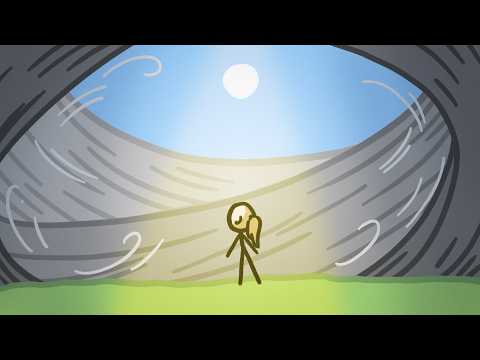
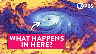
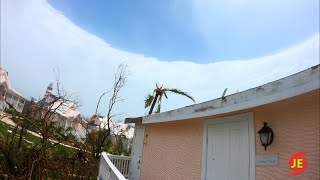
Sometimes –right after a particularly nasty part of a hurricane– the wind calms, the sky clears, and the air warms; the weather isn’t just better, it’s beautiful. But then, just as suddenly, the weather turns wild again, battering the area with a second super-intense burst. This weird lull in a hurricane is called the “eye.
” But why does this lull exist in an otherwise-violent storm? Let’s start in the bathtub. Hi, I’m Kate and this is MinuteEarth.
To get why hurricanes have eyes, you have to think of hurricanes as huge masses of spiraling fluid, since –in a lot of ways– air acts like a fluid. But hurricanes are complex –so complex that even scientists still have a lot of questions about what goes on inside them– so for now, let’s look at a simpler (and more familiar! ) example of a spiraling fluid: water draining out of your bathtub.
When you open the drain, the water in the tub starts spinning inwards, moving faster and faster as it circles closer and closer to the drain. There, all the swirling water converges and it has to go somewhere; unsurprisingly, it flows down the drain. For a while, you might just see the water gently swirling.
But when the water really gets swirling fast, it starts getting pulled outwards, just like kids on one of those playground spinners. And once it gets pulled outward enough, it forms a hollow cone, which fills with air. This is pretty intuitive, right?
And scientists think a hurricane’s eye forms in more or less the same way. There are a few differences, of course; hurricanes happen on a much larger scale –kilometers rather than centimeters– and instead of all that converging fluid spiraling downwards, the converging air in a hurricane spirals upwards. Nonetheless, the dynamics of these swirling fluids are remarkably similar.
Just like the water in the tub, if the air near the center of a hurricane is spiraling quickly enough, it will get pulled outward, forming that hollow cone. And when this happens, calm air from above sinks slowly into the cone, creating a calm core within the violent spiral: an “eye” within the “eyewall”. As the air sinks, it encounters higher and higher pressure as it gets closer to the Earth’s surface – and as air gets compressed, it warms up.
Add that warmth to heat that’s released by the spiraling eyewall, and a hurricane’s eye can get more than 20 degrees warmer than anywhere else in the storm. Plus, since warm air can hold a lot of moisture, that sinking warm air clears away clouds and rain; if you’re standing in the eye, you can often see the sun above. Which sounds really beautiful – and it is!
But when the weather clears, people that have been hiding out for hours often emerge from their shelters. And because the eye is tucked into the center of the violently-spiraling winds of the eyewall, one of the scariest parts of the hurricane is about to hit, basically without warning. So in some ways, a hurricane’s eye can be a liability.
But it can also help forecasters monitor a storm. See, just like water slowly circling a drain doesn’t form a clear hollow cone, a hurricane that isn’t spiraling very quickly doesn’t hollow out enough to pull air into its center, so the eye doesn’t clear out. But if forecasters watching a storm see the center begin to clear, they know that the air at the center is spiraling more quickly, which means the hurricane is intensifying.
So in a way, the eye keeps us from being blind. Understanding what goes on in a hurricane is critical to reducing the damage these violent storms cause. That’s why Florida International University –the sponsor of this video– is involved in hurricane research at every stage.
Researchers there are doing important research on hurricane dynamics; a big thanks to FIU’s Hugh Willoughby, in the department of Earth and Environment, for helping us research this video. FIU’s Extreme Events Institute developed the “Wall of Wind”, an NSF experimental facility that can simulate up to Category 5 hurricane winds to test construction materials and strengthen building codes. Researchers there have also developed a model to estimate the storm surge that coastal areas will experience during an approaching storm.
And –along with FIU’s School of Business– they created the Florida Public Hurricane Loss Model, as well as lead a multidisciplinary team of experts to determine hurricane insurance rates. To learn more about FIU’s incredible hurricane research, visit FIU.
Related Videos

19:22
What Causes the Worst Hurricanes (It’s Not...
Real Science
1,454,011 views

4:19
The time I was a human incubator
MinuteEarth
186,371 views

12:33
Inside a Category 5 Hurricane Simulator
Be Smart
360,049 views

11:11
What Happens AFTER Nuclear War?
Kurzgesagt – In a Nutshell
8,856,302 views

7:05
Why Don't We Eat Carnivores?
MinuteEarth
2,686,114 views

19:03
What La Niña Will do to Earth in 2025
Astrum
1,971,780 views

4:46
Eclipses Used To Be Terrifying
MinuteEarth
819,026 views

4:22
Why Monkeys Can Only Count To Four
MinuteEarth
752,434 views

3:29
The Hurricane Category Scale Is Broken
MinuteEarth
1,043,508 views

9:54
Mark Rober Reacts to Kid’s Genius Inventions
CrunchLabs
12,310 views

13:06
HUGE Magnet VS Copper Sphere - Defying Gra...
Robinson Foundry
942,748 views

3:47
Our Lungs Have A Fatal Flaw
MinuteEarth
1,458,603 views

3:22
The WEIRD Way Monkeys Got to America
MinuteEarth
1,224,653 views

6:29
The Strange Physics That Makes Hurricanes ...
Be Smart
800,321 views

22:49
How To Squeeze A Human Being Through A Fiv...
Joe Scott
1,772,126 views

22:59
Hurricane Dorian's Cat 5 Blue Sky Eye
Jim Edds
1,800,872 views

3:35
Why Hurricane Paths Are WEIRD
MinuteEarth
167,347 views

10:25
What is Storm Surge?
Practical Engineering
631,693 views

20:25
Biggest Megaprojects Under Construction in...
MegaBuilds
1,918,923 views

4:05
What Happens When Predators Disappear?
MinuteEarth
188,940 views