Tropical Cyclone, Hurricane, Storm Formation explained | Cyclone Biparjay in Arabian Sea, Gujarat
2.35M views1581 WordsCopy TextShare

Amit Sengupta
In this video we will learn about how Tropical cyclone, hurricane, storm are formed. It originate o...
Video Transcript:
in this video we are going to learn about tropical cyclones the first thing you need to understand is that tropical cyclones originate over oceans in tropical areas and coastal regions if you all know this is the tropical region it is the region of the earth near to the equator and between the Tropic of Cancer in the northern hemisphere and the Tropic of Capricorn in the southern hemisphere tropical cyclones are known by different names depending on the region in the Indian Ocean they are known by simply cyclones if you go to the western Pacific side or
near the South China Sea it is called as typhoons likewise near Western Australia it is known by relieve Lee's all these are different names refer to the same type of storm you must be knowing this that tropical region receives the most solar radiation per area and the reason behind that is due to the incoming solar radiation that are direct and vertical at the tropical region and as you move towards the polar region the angle of the sun rays are not vertical they are slanting rays vertical rays of sunlight are more effective in producing light and
heat than slanting rays and that's why the tropical region is warm now that you have understood the main things about the tropical region let's understand about wind movement when the movement is determined by low pressure and high pressure systems it is the differences in atmospheric pressure that creates pressure gradient and makes the wind move and wind always blow from the areas of high pressure to low pressure areas now the next question is what causes low pressure and high pressure low pressure occurs when air is warm either from being over a warm land or ocean surface
that means low pressure occurs at a place which is warm and how does a place become warm because of the incoming heat from the Sun that is why tropical region is a perfect place where low pressure occurs similarly high pressure occurs when air is cool either from being over a cool land or ocean surface that is why in the polar region that is you're not in South Pole it is a high-pressure zone and always remember rains blow from the areas of high pressure to low pressure areas while all of this happens there's another important phenomena
which comes into the picture it's called Coriolis force due to the rotation of the earth the earth rotates towards the east and that's why the Sun Moon planets and stars all rise in the east and go towards the west anyways due to the rotation of the earth there is a force that is generated and it acts perpendicular to the direction of motion and to the axis of rotation in simple terms when the earth is spinning in its axis from west to east and we also know that earth is a sphere and it is much wider
in the middle as a result the speed of the surface of the earth at the equator is much faster than the speed at the poles so if anything has to come straight from the poles towards the equator it gets deflected to the right in the northern hemisphere and to the left in the southern hemisphere and this force that we are talking about is called Coriolis force it causes fluids like water and air to curve as they travel across or above the earth's surface due to Coriolis force the air in the northern hemisphere gets deflected to
the right side now you might think no that is going towards the left side but then I said the air is going to curve to the right side in the northern hemisphere to clear your confusion you have to actually see it from the direction in which the when this moving so what I'm going to do is I'm going to rotate this picture and now put yourself in the path of the wind now you will be able to see that the air in the northern hemisphere curves to the right while moving from high pressure to the
low pressure area similarly in the southern hemisphere the air is deflected to the left side while moving from high pressure to low pressure area in this case we don't have to rotate the picture now that you have understood why the air moves to the left and right due to Coriolis force just remember this point that it is because of this reason there are certain pressure belts all over the Earth's surface you must be familiar with this picture which shows global wind circulation pattern you can see that at different latitudes there are different pressure belts their
existence is simply due to the movement of air to the left and right due to Coriolis force I hope so far you have understood the general movement of air now let's understand how this air turns into a storm and what causes the spinning of a cyclone when you look at the movement of a cyclone at the center of every cyclone or hurricane you will find an area of low pressure which attracts the cool air since we know that air moves from high pressure area to low pressure area that means the outer area of a cyclone
consists of cool air coming from high pressure area which surrounds the central low-pressure area this region is called the eye of the storm or center of this storm the low-pressure region is a warm region where the air is warm which expands and then Rises the cool air from high pressure zone rushes in to fill the void left by the rising warm air this air warms and becomes moist as well allowing it to rise then more cool air rushes in to fill the void the warm moist air cools as it rises higher into the atmosphere because
temperature drops with increasing altitude that is also how clouds are formed now this process continues again and again as a result you will see an eye like figure at the center of the storm now comes the Coriolis effect in the northern hemisphere the cool air rushing towards the center of the storm is deflected slightly to the right but keep in mind the cool air keeps getting attracted towards the center because that's where the warm low-pressure zone is while moving towards the center the cool air keeps getting deflected now this creates a spin in a counterclockwise
direction in the southern hemisphere the Coriolis effect moves air to the left opposite to what happens in the northern hemisphere as a result the spinning of this cyclone is in a clockwise direction in the southern hemisphere tropical cyclones are intense and in the beginning we have read that it occurs over the ocean surface and coastal region because there is a continuous supply of moisture from the ocean or sea when it reaches the land the moisture supply is cut off and the storm dissipates when the cyclone crosses the coast because after that the landmass starts so
the place where tropical cyclone crosses the coast is called the landfall of the cyclone meaning the power of this cyclone naturally decreases because the supply of moisture is cut off the average diameter of a circulating tropical cyclone can vary between 150 and 250 kilometers however the diameter of this storm over the Bay of Bengal Arabian Sea and Indian Ocean is between 600 to 1200 kilometers and these cyclones move slowly at a speed of about 300 to 500 kilometers per day so far we have seen the top view of a tropical cyclone and this is what
it looks but eclis this is the eye of the storm around the eye is the eye wall if you look at the height of the cyclone the circulation of the tropical cyclone extends up to the troposphere that is around 15,000 to 18,000 meters when warm moist air rises up in the atmosphere after a certain height it starts cooling because the temperature drops with increasing altitude as the air cools it becomes denser and move towards the ground this is called subsiding warm air and this is what intensifies this storm by increasing the diameter of this storm
and as the diameter increases these spiral rain bands expands and pushes the rain clouds into the outer region tropical cyclones occur at the time of maximum solar radiation during the summer and autumn season that is around July to October time in the Northern Hemisphere and December to March time in the southern hemisphere with this I hope you have now understood the complete anatomy of a tropical cyclone if you still find it a little confusing I recommend that you go back and watch the video again especially the part where I said that the air in the
northern hemisphere curves to the right when moving from high pressure to low pressure area and in the southern hemisphere it curves to the left many people find that concept a little confusing so watch it again if you understand the clockwise and anti-clockwise movement of the air then you will understand everything anyways I hope you found this video informative let me know your thoughts in the comment section thanks for watching and I'll see you in the next one
Related Videos
6:14
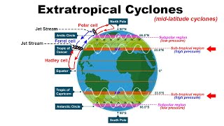
Extratropical Cyclone formation | Climatol...
Amit Sengupta
437,560 views

Relaxing Piano Music & Water Sounds 24/7 -...
OCB Relax Music

19:22
What Causes the Worst Hurricanes (It’s Not...
Real Science
1,552,452 views

27:25
TROPICAL CYCLONES || Full Explanation || W...
Samajho IAS
299,867 views

Relaxing Music to Relieve Stress, Anxiety ...
Soothing Soul

21:43
I Spent 100 Hours Inside The Pyramids!
MrBeast
39,633,096 views

17:48
Why Rivers Move
Practical Engineering
2,890,015 views

21:44
Bangladesh Myanmar Border Issue | Who are ...
Amit Sengupta
199,823 views

38:21
"BMW mandou andar com carro e pegou fogo"
Celso Russomanno
44,804 views

1:45:22
Condenação Brutal com STALLONE // Filme Co...
Film Plus
520,387 views
9:06
Why Australia’s Doomed Dam Can’t Be Fixed
The B1M
1,243,956 views

9:25
GR3NAL ALUCINANTE ! TEVE GOLS, EXPULSÃO BI...
FutBol HD
225,348 views

12:21
Subtropical high, Subpolar low, Easterlies...
Amit Sengupta
1,299,115 views

12:32
China's Deepseek AI Explained
Amit Sengupta
49,469 views

1:02:47
Important Geographical Terms Features Land...
Amit Sengupta
5,198,421 views

1:30:41
Complete Climatology | L9 | Tropical Cyclo...
Let's Crack UPSC CSE
67,900 views
3:42
Formation Of A Tropical Cyclone
ClickView
1,425,426 views

12:30
Polar Vortex - How it's formed & When it i...
Amit Sengupta
337,105 views

13:21
What Did Pangaea Look like?
Atlas Pro
6,698,583 views
4:12
How do tornadoes form? - James Spann
TED-Ed
10,087,074 views