A Significant Winter Storm Is Developing...
1.29M views2237 WordsCopy TextShare
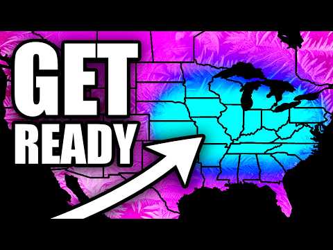
Ryan Hall, Y'all
A powerful winter storm system is set to bring multiple hazards across the country, including danger...
Video Transcript:
happy New Year everyone it's January 1st 2025 and we're starting off with a bang here as we have a real winter storm to talk about there's a modeled storm that's within close enough range to actually talk about it's not in la la land anymore so that's what we're going to do today and this has the opportunity to be a major winter storm that affects millions of people from the central United States all the way over to the Eastern United States and it all starts way above our heads here at the 500 100 mbar level we're
going to have a bunch of wind this week above our heads just driving down cold air into the Central and Eastern United States and you are going to feel this there's going to be some quite chilly temperatures you know in some places where it's been a little bit warmer than average here but you're not going to think too much of it until those temperatures are met with a significant amount of precipitation which is what's going to happen here sooner than later around January 3rd here we're going to see our jet stream just really start cranking
here pointing towards Florida and this is going to act like a vacuum sucking the cold air right out of the Arctic and dumping it over Tennessee you know Kentucky and and especially in the Northern Plains Friday through Sunday there's a couple areas up here that will'll see 30° wind chills in the mornings so it's going to be cold now that cold air is going to continue to compile and set up over the Eastern us and what's going to happen here between Friday and Saturday is there's going to be a little bit of a trough working
into the western United States this is going to bring about some rain and some snow uh to to the west but once it gets over the Rocky Mountains it's going to allow for some more moist air to kind of fight against the cold air that's been streamlining down for so long and of course whenever that happens we're going to get ourselves a full-on storm system especially uh on Sunday January 5th here we're going to be talking about a lot of different things from a major snowstorm somewhere up here to a potential ice storm and also
a very real likelihood of a severe weather outbreak let's put some on here and show you a little bit more of what I'm talking about now this is the GFS ensembles okay it's not the deterministic model it's not as fun to look at because it's a little bit more conservative because this is a mixture of a bunch of different models put into one and therefore it's more accurate you can see that we are going to have a pretty widespread lighter snowfall event uh here between Thursday and Friday from the Great Lakes down to the appalachin
that's just kind of a primer and that's going to be associated with all those really strong winds coming down from uh Canada the upper levels that are going to be bringing down the Arctic air but look at all that snow and rain over there in the Cascades over towards the Inner Mountain West that's going to hop Over the Rockies and once again Saturday evening into Sunday we're going to see an explosion and precipitation here on the other side of the Rockies where we're going to see snow in the north a mixture of rain and snow
in the middle more than likely some rain and some thunderstorms in the South and the area that I'm most concerned about honestly at this point is going to be that mixed precipitation area in the middle guys this has a real real potential to end up being a ice storm for somebody it's too early to talk about specifics there but this has ice storm written all over it we've seen a lot of storms like this in the past and I think that there's going to be a lot of people under the gun for potentially over a/
inch of ice by the time this is all said and done and not a small area either a very large area whoever ends up on the Northern side of the ice is going to get a big snowstorm as well right now the ensembles are are saying the rain snow line is going to be somewhere north of the oh River but once again that'll shift up and down a little bit and something else that I want to draw your attention to is the farther east this thing goes the weaker it gets okay this doesn't look like
it's going to be one of those storms that phases with another system from the Gulf or the Atlantic and turns into a large winter storm on the East Coast this looks like an Ohio Valley and Great Lakes classic all right so it doesn't look like this is going to transfer over to the east coast as much now the Mid-Atlantic interior Northeast the Appalachian mountain region there's definitely something there for you but right now this is definitely going to be blowing up over this region for the most part okay so this is where we have the
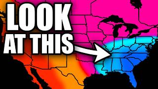
best chance of seeing some sort of significant winter precipitation specifically between January 5th and January 6th if you're in that blue area there I think that it's a shoe in okay you're either going to get ice or snow every day I'm going to be making a video and as we get closer I'll be able to nail this down a little bit more for you but I'm 100% confident that we're going to have some sort of winter precipitation in the blue area so go ahead and start preparing this could end up being a snowstorm that brings
about 4 in or more of snow or like I said earlier this could be an ice situation that might even cause power outages so this is something that you might want to go ahead and start preparing for now once again we're talking about the time frame between Sunday January 5th and Monday January 6th the farther away you get from that blue area we just become a little bit less confident and the thing is is the the models are going to change over time and the heaviest axis of precipitation could end up farther west further east
farther south farther north going to be somewhere in this big green blob though with the highest confidence being right there smack and dab in the middle here's what the big averaging model the GFS ensembles is saying about snowfall totals once again there's a couple of different hot spots here right around St Louis points north towards the tri-state area between Iowa Illinois and Missouri there's a somewhat high probability that somewhere in there we'll see over 6 in of snow same thing for you guys over here along the border of Ohio and Indiana of course we do
expect some higher totals in the higher elevations and then there's going to be some residual Lake Effect and Lake enhanced snow to talk about up here in the Great Lakes region as well but again anywhere in this larger Blue Area could end up seeing a significant amount of snow from this storm we're still 5 days out or so it's too early to be like okay this city is going to get 6 in this city is going to get 8 in some people are going to try to do that your local weather person might try to
do that already you're going to be mad at them because it is going to change now the European Ensemble models have this really cool thing that shows us where we have the highest probability of seeing 6 in or more of snow and honestly this is really high uh around the St Louis area over here there's a couple of places that have a 60% probability of seeing more than 6 Ines of snow by the time we get to January 7th and the heaviest axis of snow right now looks to be right in this region from Cincinnati
to St Louis over towards Southern Ohio South Central portions of Indiana and Illinois I think that we're definitely going to be talking about some sort of winter storm in this area and last but not least we are concerned about the ice right and like I said this looks like it has the potential to be a widespread potentially damaging ice storm it's too early to talk specifics but the deterministic models are painting a pretty concerning looking scenario here any of the darker pink areas that you see here could potentially have more than a half inch of
ice on the ground by the time we get to January 7th that would cause you know hundreds of thousands of power outages travel problems and just a lot of really unfortunate stuff this is something that we have to keep an eye on it'll be easier to forecast the snow okay I'm going to be able to tell you exact numbers for snow a lot sooner than I'm going to be able to tell you exact numbers for ice but if I'm in southern Missouri if I'm in Kentucky if I'm in uh the mountains of Virginia West Virginia
North Carolina I would definitely be concerned about this one and potentially getting ready gas up the generator that kind of thing and of course on top of all of that we have a rare day five slight risk of severe weather from the Storm Prediction Center so once again it looks like we're going to have a snowstorm an ice storm and a severe weather situation with potential tornadoes all at the same time on that January 5th through January 6th time frame similar to the ice situation it's going to be a couple more days before we can
give you specifics on this but there is going to be a pretty good setup for severe weather here especially during the evening on Sunday once again I think this is a day that where we could even be live talking about snow ice and then we've got enough low-l Shear here to where I think that this right now looks like a pretty prolific tornado threat from Jackson Mississippi back through shreport and unfortunately this does look like it has a nighttime component to it so we're going to be talking about maybe more nocturnal tornadoes down here unfortunately
so a very busy weather day Sunday January AR 5th just make sure you are prepared okay and I'm going to have daily video updates as we go forward keeping you up to date on the latest and every day I'm going to be able to become a little bit more specific about the tailored threats for each area this video right here is more to serve as a heads up all right something's coming we're close enough now to where I'm confident to talk about it and start getting you ready but we're not close enough yet to pinpoint
specific actions that people need to take that might be tomorrow for the snow probably be the day after after that for the severe weather and then the day after that for the ice once we get to Friday we're going to have a very detailed forecast for you but keep checking in as things change each day and of course this storm is going to kick off our very cold pattern once again that wind is bringing down the cool air into the southeast it'll be cold from you know Dallas uh up to Washington DC by tomorrow for
most of everybody not bone chilling but cooler than average and then just as we go forward the Cold's just going to get more uh significant and intense so we're going to have WID spread cold on January 4th it's going to be warm in the west and the slip and slide of cold air from Canada is just going to be open for business sun and it's not going to go anywhere this is going to be high quality cold air that lasts for a long time all the way through the middle of January we are going to
have this arctic cold air mass sticking around on the east coast and there's going to be a lot of opportunities for snowstorms this is the best pattern that this area has been in for snow in over a decade all right so so make sure you are ready for snow if you live on the east coast once again sorry about my voice I'm still under the weather but I don't know if you can tell but I'm slowly but surely feeling better so hopefully by the time we actually get to the snowstorm I'll be back to normal
okay thank you guys for watching make sure you subscribe and turn notifications on as it does look like we're going to have daily updates going forward and I will see you in the next one goodbye
Related Videos

10:56
This Winter Storm Is About To Cause HUGE P...
Max Velocity - Severe Weather Center
227,547 views

Watch Live: FBI, officials discuss investi...
Face the Nation

13:16
Two Storms Systems Coming...
Mr. Weatherman
34,960 views
11:35
This Is About To Seriously Change Our Weat...
Ryan Hall, Y'all
867,896 views

Off to Syracuase for Lake Effect Snow - LI...
Storm Chaser Brandon Copic

11:51
Huge Change After This Thanksgiving Storm...
Ryan Hall, Y'all
476,071 views
13:50
The Jet Stream Is About To Go Wild...
Ryan Hall, Y'all
726,471 views

10:40
This Storm Will Impact Millions Of People...
Ryan Hall, Y'all
803,900 views

11:00
December Weather PLOT TWIST Incoming...
Ryan Hall, Y'all
993,556 views

23:45
You Won’t Believe What Showed Up in the Ne...
Mrs Cog Hill Farm
7,635 views

11:31
This Christmas Week Is About To Feel VERY ...
Ryan Hall, Y'all
516,006 views

10:33
Don't Underestimate These Upcoming Storms...
Ryan Hall, Y'all
387,736 views

10:38
This Winter Storm Is About To Cause Major ...
Ryan Hall, Y'all
1,195,292 views
52:47
Major Winter Storm Update! Winter Weather ...
Mitch West Weather
18,266 views

10:24
An ACTUAL Cold & Snowy Pattern Is Coming...
Ryan Hall, Y'all
735,426 views

9:47
A Concerning Storm System Is Setting Up...
Ryan Hall, Y'all
779,044 views
9:41
The Next Few Days Will Be VERY Active...
Ryan Hall, Y'all
463,261 views

11:21
A Major Pattern Change Is Coming...
Ryan Hall, Y'all
543,772 views

11:26
This Storm Is About To Seriously Pop Off...
Ryan Hall, Y'all
551,112 views

9:36
Our Strange Weather Pattern Gets Even Weir...
Ryan Hall, Y'all
370,398 views