Why Hurricanes Are Becoming More Dangerous
392.5k views2137 WordsCopy TextShare
StarTalk
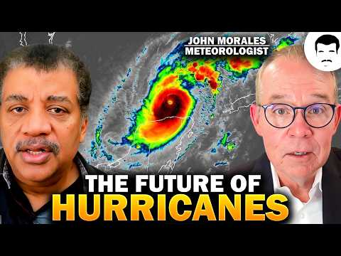
How do big hurricanes form? Neil deGrasse Tyson teams up with meteorologist John Morales to explain ...
Video Transcript:
[Music] this is Star Talk Neil degrass Tyson here your personal astrophysicist I have with me a 40y year veteran of meteorology John Morales John welcome to Star Talk oh it's it's incredible to be here so honored now I check in your bio you are based in Miami Florida which means as a meteorologist hurricanes might preoccupy your time and attention especially in the fall just just by a little bit and we are recording this one day before hurricane Milton makes landfall on the west coast of Florida and so before we discuss more about what may be
different about that hurricane uh let's just lay some foundations here the meteorological community at last I checked names all storms all low pressure systems that build in the Atlantic and only some of them become hurricanes that is correct uh they've been using names uh alphabetically uh since the 1950s um and first it was all female names and that rightfully so in the 1970s that was changed after some protests uh because women felt that why would only women names be associated with devastation um uh so now they alternate male and female names in four different languages
uh Anil uh the they they use English of course but also you have to remember all the languages spoken across the Atlantic Basin so Spanish is also utilized Dutch for some of the Dutch Antilles and French of course because French is spoken in some of those uh Caribbean islands too what makes the fall so susceptible to hurricanes when we don't typically think about them in the winter spring and summer yeah what's going on is that you know throughout the summer in the northern hemisphere you have of course the Northern Hemisphere absorbing quite a bit of
solar radiation throughout the process of of of the summer and you don't see the peak of uh ocean heat content happening until later much later than than uh uh you know the summer solstice which would be what June 21st or so so if the oceans are warmest not at the summer solstice but later into the end of summer and beginning of autumn in the northern hemisphere now that is when you'll see that peak of hurricane activity because tropical storms uh feed off of warm waters you know the air starts to rise because it's buoyant much
like a hot air balloon would rise when you when you use that flame right so as that air is rising the pressure at the Surface starts to diminish the the weight of the column of air that is above you starts to diminish and then all the air that's around that region wants to rush in to fill that relative vacuum as that happens what's the air what are these air molecules going to do as they Rush towards the center they start to also rise they congregate they Clash the air molecules rise there's no place else for
them to go no place else for them to go because can't go into the ocean not dense enough for that to happen so so you've got further rise of air into the upper atmosphere now let's get to the moisture part because that's really important this is really humid air okay all this moisture is being EV operated off the surface of of the ocean and as that happens uh and the air rises in our lower atmosphere known as the troposphere there generally you will find that the temperatures are decreasing as you rise up into the troposphere
well the moisture that is in the air which is in the form of water vapor now as it ascends the temperature drops and the temperature and the dupoint temperature start to get closer to each other dupoint is a direct measure of how much water vapor is in the air okay and the more water vapor you have the higher that dupoint temperature is when the air temperature and the the dupoint temperature match you have reached full saturation and the this condensation process releases energy and you and I can explain this together if you want but if
if to boil water you need to add heat for that to happen well what's the opposite of boiling water condensing water so where is that energy going the energy is released that's why it's lat and as it goes up energy is released and that simply adds to the entire process of the buoyancy the entire process of the Winds accelerating at the surface because you get more of this vertical motion happening uh so the pressure continues to drop at the surface the air continues to try to rush into the center the winds and the process are
accelerating and that's how you get uh tropical depressions to become tropical storms to eventually become hurricanes so now when the storm gets strong enough what's the threshold for Hurricane classification the wind speed is it a wind speed or air pressure measure no it's it's wind speed you reach uh hurricane classification When You Reach wind speeds of 74 miles per hour and then within the hurricane uh bracket which is quite wide it is subdivided in the sapper Simpson scale it's which is purely these days a wind scale and not a storm Sur scale I was looking
at the Wiki page on the saffer Simpson scale and I was reading from category 1 to Category 5 in sequence and it was like Dante's descent into hell first one uh some tiles will blow off your roof that's it some trees will bend a little some flooding okay then in number two all roofs are gone all leaves are stripped off of trees that keep going up bark gets stripped off of trees and category five there's no trees left and I said oh my gosh right if anyone had to describe a descent into hell it's the
saffer Simpson scale going from one to five that's right and and and that's why sometimes especially in in in this era that we're living in you see these hurricanes like Otis in 2023 off the coast of uh Acapulco Mexico go from a tropical storm to a category 5 in the span of less than 24 hours the um force on any surface from moving air from wind moving air the force on any surface is it's a quadratic uh proportion or equation so if you if you double the wind speed it's four times the fourths if you
triple the wind speed it's nine times the fourths right three squared is nine uh so 150 m per hour hurricane has nine times d ruction Potential from wind alone than a 50 mph tropical storm just this morning I rewatched Carl San's testimony in Congress in 1985 warning lawmakers about the dangers of continuing to stoke this greenhouse effect from the carbon dioxide in the atmosphere uh as air temperature rises it seems to me it could hold more moisture if we have a warmer Earth so why does that automatically mean because we've been told that it would
give you either more storms or more severe storms when you can add 7% more moisture for every 1 degree celsius that you increase the temperature of the atmosphere right so so I mean 7% is a non-trivial amount okay because you know when you're when you're talking about what just happened in the western North Carolina mountains with hurricane Helen you know do you think that 7% makes a difference of course it did so when it rains it rains harder in a in a warmer world now when it rains it rains harder and because the oceans so
the the oceans all over the world are pretty much at record hot levels there are some exceptions you know off the coast of Greenland for example and we can talk about why but but uh mostly especially the tropical belt you'll find that the oceans are generally warmer there are by the way some short-term natural climatic variations like elino and Lino which can change uh the uh surface near temperature in the equatorial Pacific for example just just to give you some of those short-term natural variations but the trend overall uh since 100 years ago has been
for warming of the oceans and I bring this up because again the main factor that drives the intensity of tropical Cyclones all around the planet not just in the Atlantic is the sea surface temperatures and the amount of ocean heat content that have speed limits for hurricanes have changed and I'm not talking about how fast it moves across the ocean I'm talking about how fast the wind speeds can get I noticed from the hurricane maps that hurricane Milton was birthed in the Gulf of Mexico and I hadn't typically you know my stereotype of a hurricane
is one that forms you know halfway across the Atlantic and migrates towards the Caribbean and either goes up the coast or crosses over so so how often do you get a hurricane forming in the Gulf of Mexico you mentioned Milton and there are there are some unique aspects or at least unique in the last uh 150 plus years with okay yeah so unique in modern civilization yes okay correct always important to to state that caveat but uh you have to go back to the mid 19th century to find a hurricane that formed in in the
Far Western Gulf of Mexico and traversed west to east nearly I know at the end Milton is you know has made a turn to the Northeast but you know traversing west to east that is highly unusual highly unusual and and and the reason it's memorable from the 19th century is because these systems that hit the Florida coast in perpendicular fashion in other words the West Coast of Florida kind of sort of oriented north south the hurricane kind of sort of going straight west to east uh well it hits the coast perpendicular and it causes a
greater storm surge storm surge is dependent on many factors including the angle of approach of the hurricane to the coast uh so is it is it the new normal that we would be getting hurricanes that are rare possibly unique in their form and their Devastation listen we're already seeing that some of some of the storms that were concurrent with um Milton Leslie and Kirk each one of them set records for being the strongest hurricanes ever recorded So Far East in the Atlantic so late in the season that that's a mouthful but yes okay yes yes
right so so you know in October hurricane way out there in the Atlantic closer to Africa than the United States okay becoming a hurricane that had not been seen again in modern records which date back to 1851 but by the way by pressure Milton is now the fifth strongest hurricane ever recorded in the Atlantic Basin so John you're a meteorologist and you report this on television and people want advice from you they see a hurricane is coming our models are good we know when it's going to landfall what do you tell people to do well
in a nutshell you run from the water and you hide from the wind um so you know you must run from the water why because if you're going to get a storm surge that is 8 10 12 15 20 feet high uh that becomes unsurvivable you you just you can't swim in that or if you're trapped in your house you get trapped in the attic and you drown uh so so you run from the water uh so thank you for sharing uh some of your time with us uh just can you give a shout out
to the station who you report with of course uh so I'm the hurricane specialist former chief meteorologist now hurricane specialist for nbc6 uh it's in the Miami Fort lauderale Market also serving the Florida Keys too it's the local affiliate and your call letters are what there wtvj there you go oldest station in the State of Florida so we look forward to not only tapping your expertise but the the strong dose of humanity you bring to your reporting which we all value so thank you John thank you thank you very much all right this has been
a Star Talk explainer trying to understand the current hurricane season and going into a future of what may be the unfortunately may be the new normal facing us all until next time keep looking up [Music]
Related Videos
13:11
What Will Our World Look Like at 4 Degrees?
PBS Terra
370,516 views

37:17
Astrophysicists Discuss Our First Encounte...
StarTalk
300,759 views

22:09
Is This The Craziest Space Weekend In Hist...
Scott Manley
14,167 views

28:24
Why does the US spend so much on its milit...
Johnny Harris
1,451,347 views

1:22:22
The REAL Life & Times Of Krishna - Nilesh ...
BeerBiceps
456,635 views

16:13
Duracell PowerCheck: A genius idea which d...
Technology Connections
2,014,220 views

16:03
The biggest JETS from a BLACK HOLE ever found
Dr. Becky
92,624 views
19:03
What La Niña Will do to Earth in 2025
Astrum
1,980,191 views

13:06
HUGE Magnet VS Copper Sphere - Defying Gra...
Robinson Foundry
1,083,304 views

53:11
Neil deGrasse Tyson and Richard Dawkins Di...
StarTalk
3,365,794 views

16:22
Aerospace Engineer Answers Airplane Questi...
WIRED
1,080,446 views
7:43
THE RISKIEST Places to Live in the US as O...
PBS
49,191 views

22:06
Meet Shantanu Naidu: Millennial Who Won Ra...
moneycontrol
2,153,183 views
17:34
How Gravity Actually Works
Veritasium
12,357,913 views

11:36
5 Things About Geography You’re Wrong About
Sideprojects
626,466 views

30:09
30 Car Engines That Will Last FOREVER (2024)
SUV Zone
467,968 views
17:32
What If The Cosmological Constant Is NOT C...
PBS Space Time
281,597 views

11:35
There Is Something Hiding Inside Earth
Kurzgesagt – In a Nutshell
3,647,304 views

24:00
Simon Sinek & Trevor Noah on Friendship, L...
Simon Sinek
1,745,393 views

19:22
What Causes the Worst Hurricanes (It’s Not...
Real Science
1,455,738 views